Norway, Scandinavia’s most majestic country, is covered with monumental mountains, fantastic fjords and a compelling coastline, all of which can be explored on foot. For hundreds of years, Norwegians have been retreating to their mountains to combat the stress of everyday life, which means that there is an extensive network of marked trails all across the country, from the easy that anyone can handle to the potentially treacherous that only the experienced should attempt. But whatever your skill level, there exists a law in Norway called “allemannsretten,” meaning “everyman’s right,” which gives you the right to roam free on uncultivated land, which includes hiking and camping in the mountains, forests and coastal areas, as long as you show respect for the property.
If long-distance hiking is your thing, Norway is the place for you, as the country boasts almost 50 long-distance hikes. If you’re worried about getting caught in the cold, fear not, because Norway, according to Visit Norway, has more than 550 affordable hiking cabins located throughout the country in pristine landscapes, ranging from the fairly basic to the fancy, some of which were designed by “first-rate” architects.
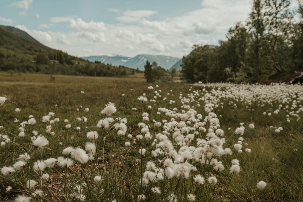
Keep in mind that Norway is mostly mountains, and is home to some of northern Europe’s highest peaks, the country’s tallest being Galdhøpiggen at 8,100 feet. These spectacular mountains are often broken up by deep valleys, fjords and lakes, while Norway’s dramatic coastline also overflows with fjords, as well as offshore islands and beautiful bays. Whatever trail you take in Norway, you will be traversing some of the most scenic terrains on Earth, so do like the Norwegians do and hit the trails.
Trollheimen Triangle Route
If you want to start your hiking adventure in the middle of the country, Trollheimen is a great place. This picturesque valley surrounded by magnificent mountains is the starting point for one of the best long-distance hikes in Norway, the Trollheimen Triangle Route, which connects three full-service mountain lodges: Gjevilvasshytta, Trollheimshytta and Jøldalshytta. Each leg of the Trollheimen Triangle takes about 7-9 hours, and part of it can be challenging.
The trail begins and ends, as it is a triangle, at Gjevilvasshytta. On your there and back again journey, you will encounter jagged peaks, pine forests, crystal-clear lakes, an abundance of wildlife and maybe even a troll or two, as Trollheimen means “Home of the Trolls.”
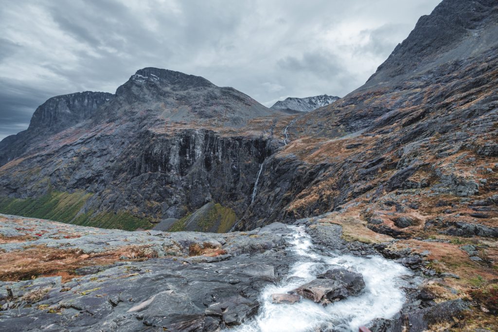
Romsdalseggen Ridge
This 7-mile point-to-point hike along a narrow ridge above fjords is widely considered by many trekkers to be the most beautiful hike in Norway. Romsdalseggen Ridge has also been called one of the most scenic hikes on Earth.
During the 5-7-hour journey along Romsdalseggen Ridge, you can see Norway at its most magnificent, including the Rauma River winding through the lush valley below, the regal Romsdalen mountains and their forest of jagged peaks, the legendary Trollveggen Cliff, aka the highest perpendicular rock face in Europe, and waterfalls galore. This hike has three routes: one easy, one moderate and an extreme trail that actually requires a mountain guide. But whichever Romsdalseggen Ridge route you take, you will not want it to end.

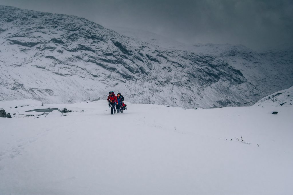
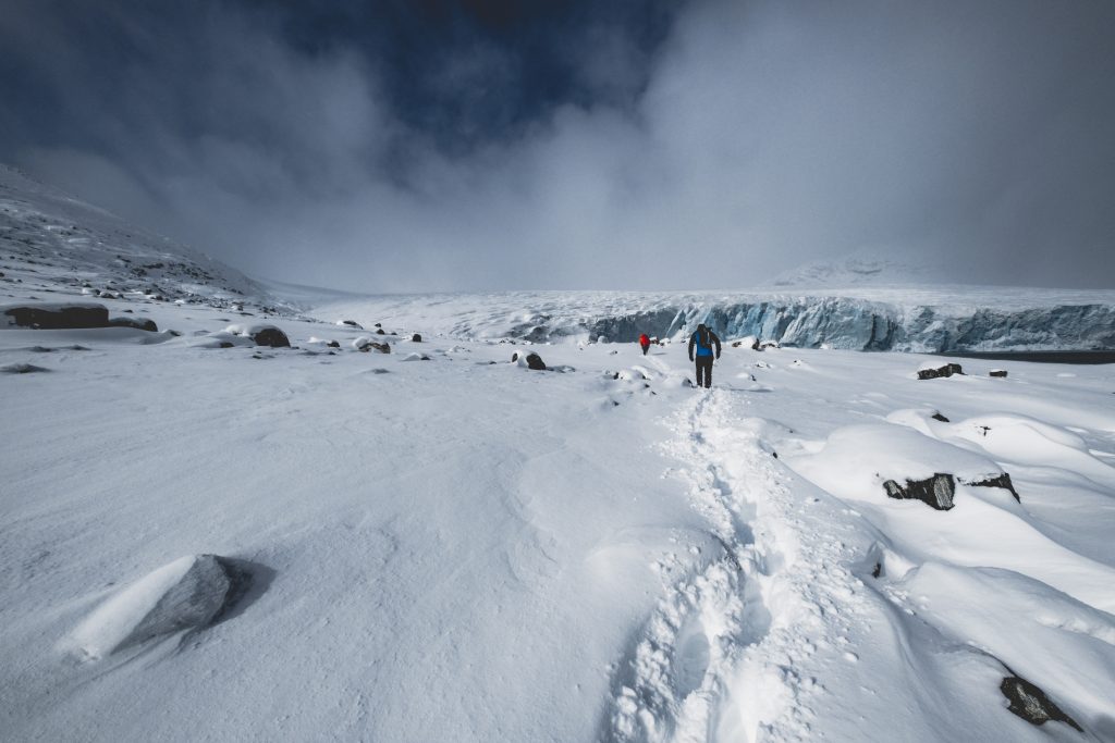
Galdhøpiggen
Galdhøpiggen is not only the tallest mountain in Norway but northern Europe. Fortunately for hikers, you can reach the top of Galdhøpiggen from a few different trails, some of which travel across glaciers and some that require a guide, although easier trails to the top exist. Hiking to the top of Galdhøpiggen, which is located in Jotunheimen National Park, requires scaling three peaks, and there are trail markers to help guide you. It will take you 6-9 hours round-trip, starting from the Juvasshytta mountain lodge or the Spiterstulen mountain lodge.
Trolltunga
Perched 3,600 feet above sea level sits something that seems to be a tongue sticking out. This is Trolltunga or Troll Tongue, and it is not actually a giant tongue, but rather a rock formation, Norwegian national icon and one of the most popular hiking destinations in the country. In fact, over 80,000 people hike to Troll Tongue every year, despite the fact that it’s a 17-mile round-trip journey and quite difficult.
This is not a hike for novices, and the Norwegian Trekking Association has classified the Trolltunga hike as “challenging,” but if you’re up for it, the 10-hour hike is extremely rewarding. Troll Tongue juts out into space over Ringedalsvatnet Lake and is the place in Norway for hikers to take pictures. It is replete with magnificent views for miles, and many consider the view from Trolltunga the wildest and scenic in the country. It is at the top of many a hiker’s bucket list for Norway.

Kjeragbolten
This literal rock in a hard place is far from unpleasant. You start on the picture-perfect shores of Lysefjorden and ascend hundreds of breathtaking meters to the large stone wedged between two rocks, while the Kjeragfossen waterfall, one of the world’s tallest waterfalls, cascades nearby to the fjord below. Be aware, however, that Kjeragbolten can be challenging, but is a favourite of experienced hikers. This is also a popular spot for BASE jumping and taking pictures while standing on the rock. Fear not, despite there being nothing but air below you and the rock, it is solidly wedged in the mountain crevice and will not go anywhere, despite one’s weight.
Pulpit Rock
Pulpit Rock is another extremely popular hike in Norway, and once you reach the top it’s almost impossible to find a more inspiring view on this Earth. From the top, you have a bird’s-eye view of mountains for miles and Lysefjorden far below from a large and flat perch. Pulpit Rock, like Kjeragbolten, is also a preferred spot for BASE jumping, but is an easier hike and less timely, at about 2 hours each way. Pulpit Rock, or Preikestolen, can get rather crowded, so hike early in the day or later and arrive on time to see an unforgettable sunset.
Mount Fløya
Mount Fløya is the ideal place in Tromsø to watch the northern lights dance in the sky if you’re here during the aurora borealis. It is also the best lookout over the city. Instead of taking the iconic Fjellheisen, a cable car, to the top, the more adventurous hike to the top of Fløya, which takes about 3-5 hours, as it is almost 7 miles there and back. There are a few trails leading to the top, but your best bet is taking the trailhead located on the southside of the Fjellheisen terminal. This leads you through an enchanted forest on a gradual incline up to the first lookout point at Storsteinen, where the Fjellheisen arrives, and then takes you to the peak of Fløya. And if you get too tired on your way back down, just hop aboard the Fjellheisen.

Kvaløya
Kvaløya, or Whale Island, is an outdoor enthusiast’s paradise all year long and is located just minutes from Tromsø. In warmer weather, this island is perfect for biking and hiking one of its towering mountains, especially on, around or up to Store Blåmann, Kvaløya’s highest peak, which stands in the middle of the island. Store Blåmann is not only the island’s tallest peak but its most demanding. However, the almost 4-mile trek, which is well-marked and well-maintained, is well worth it, as the views from the top are out of this world. For an easier hike, set your sights on the 2.4-mile trek to the top of Brosmetinden, which also has amazing views of Kvaløya. This moderate hike might also include the chance to run across a herd of reindeer.
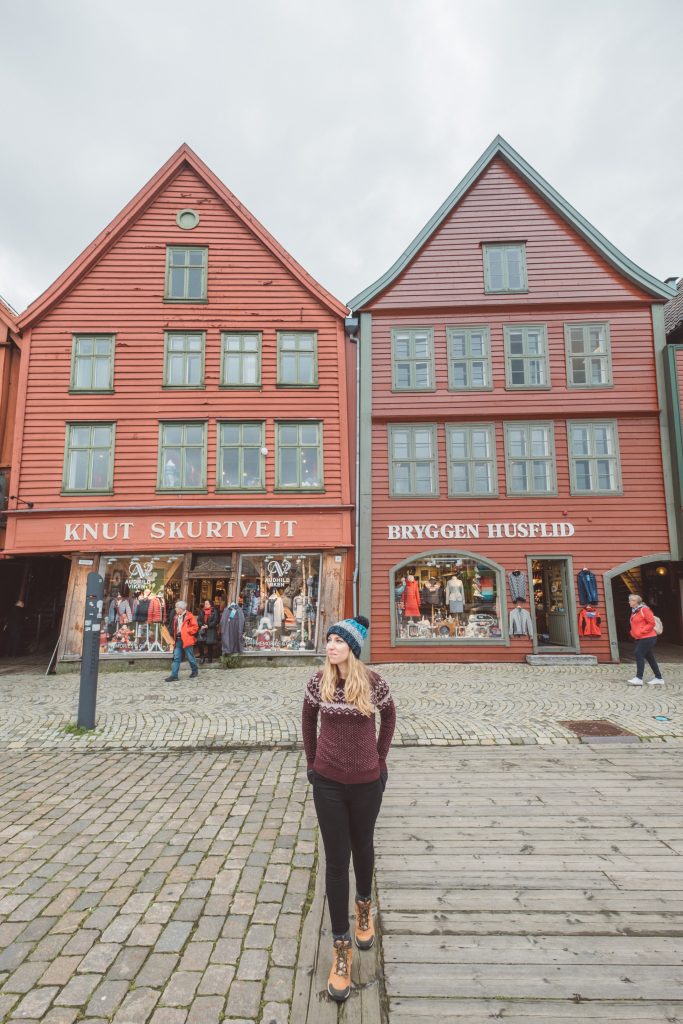
Mount Fløyen
Not to be confused with Mount Fløya in Tromsø, Mount Fløyen is one of the seven mountains surrounding the city of Bergen. By hiking to the top, you can get a bird’s-eye view of Bergen. It is not only the best hike in Bergen but one of the best in Norway. From here, you can see the historic Bryggen Hanseatic Wharf, which is a UNESCO World Heritage Site; the Bergenhus Fortress, which has stood sentinel over the entrance to the city’s harbour for centuries, and is one of the oldest and best-preserved fortresses in Norway; the surrounding mountains, which seem endless, and some scenic fjords.
This easily accessible hike, which is quite manageable for even the novice hiker, takes about an hour going up unless you stop at one of the many lookout points along the way to admire the view, take pictures and/or catch your breath, and a mere half-hour going down. Mount Fløyen is located on the northeast side of Bergen, is an easy walk to from anywhere in town and has a trail that can be picked up at various points.

Mount Ulriken
If the aforementioned Fløyen isn’t high enough for you, hike to the top of the tallest of Bergen’s seven mountains, Ulriken, on one of many different trails. Whichever route you take, which will take 3-4 hours, you are destined to be famished once you reach the top, and thankfully the Skyskraperen restaurant will be waiting for you and your appetite, as will some of the best views of Bergen. One of the most popular routes is the Sherpa steps, found by the Bergen Hostel Montana, at the base of which you will see a signboard with a map. You can also start from the base of the Ulriken cable car, and if you’re too tired after your ascent to walk back down, take the cable car back and relax while enjoying the views.
Lofoten Islands
The Lofoten Islands possess some of the most awe-inspiring scenery in Norway. This group of mountainous islands, which lie above the Arctic Circle, also have some of the most memorable hiking trails in the country. This is a place where you can not only hike under the midnight sun but beneath the flickering northern lights, depending on the season. Hikes here range from leisurely beach trails to serious backcountry treks.

Whatever island you find yourself on, you will be close to a trail. One of the most popular and picturesque hikes, Reinebringen, starts from the fishing village Reine on the island of Moskenesøya and has a steep ascent, but breathtaking views at the top of the islands, sea and the Lofoten Wall, a huge wall that rises from Vestfjorden. Another revered hike on Moskenesøya into the Munkebu Hut, which begins in Sørvagen.
This 5-6-hour hike through the backcountry passes four lakes and requires you to climb a vertical rise, which has metal supports for assistance. Once you reach the hut, you can stay the night, as Munkebu is a popular overnight basecamp for hiking to the summit of Hermannsdalstinden, the tallest mountain on the island. If you prefer the beach, catch the ferry to Kjerkfjorden and follow the signs to Horseid Beach. This moderate 2-hour hike leads you along dramatic shores to the alluring white sands of Horseid Beach, which is surrounded by towering granite peaks.
Vettakollen
If your trip to Norway only takes you to Oslo, the capital, and your time will be short, but you want to get outside, Vettakollen is tailor-made for you. This 1.4-mile, 1-1.5-hour, the out-and-back hike is easy enough for hikers of all ages and skill levels. You gain almost 600 feet to the top of Vettakollen, a peak located between Holmenkollen and Sognsvann on the northern edge of the city. Once at the top you will be rewarded with spectacular views of Oslo. The trail to Vettakollen is wide and well-maintained.


Leave a Reply